


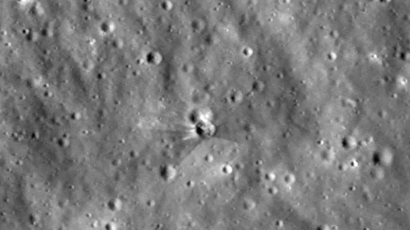
mechanism needed We spent nearly a week preparing to film the crash site of the second stage of a Falcon 9 rocket that was launched into space about a year and a half ago but, as fate would have it, crashed into the moon. But these are the best photos of the craters that formed there, beyond the reach of ground-based telescopes and other spacecraft. Thanks to NASA data, the size of a rocket stage’s impact on the moon can be estimated fairly accurately.
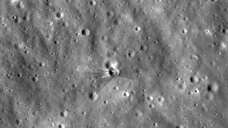
Image source: NASA
The detailed images of the new crater were taken by NASA’s Lunar Reconnaissance Orbiter (LRO) spacecraft. The stage impacted the lunar surface on August 5, 2026. It was previously used for the launch of Firefly Aerospace’s Blue Ghost Mission 1 lunar lander in January 2025. The LRO detector was only able to image the impact site on August 11 and 12, six days after the event. To take pictures, engineers had to tilt the equipment each time it flew into the impact zone at an altitude of about 96 kilometers. At the same time, the detector moves at a speed of approximately 1.6 kilometers/second, so a 10-second error in the shooting time will cause the area of interest to deviate from the center of the frame by approximately 16 kilometers. In other words, quite complex calculations are required to see the rendered footage.
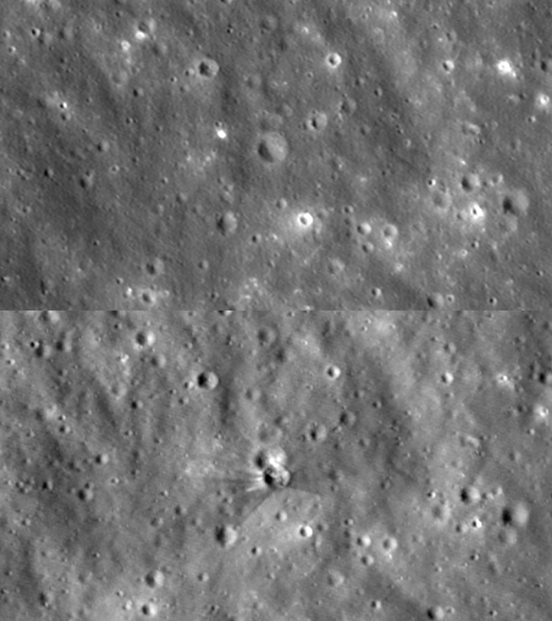
A series of images taken at different lighting angles allowed NASA to more accurately determine the parameters of the impact trajectory. The diameter of the crater is about 18 meters, and based on the length of the shadow, its depth is less than 3 meters. The photograph was taken using the LROC complex’s narrow-angle camera, which is capable of distinguishing objects up to about 0.9 meters from the surface. The varying positions of the Sun during successive flybys help reveal the topography of the crater rim and the structure of material ejected during the impact.
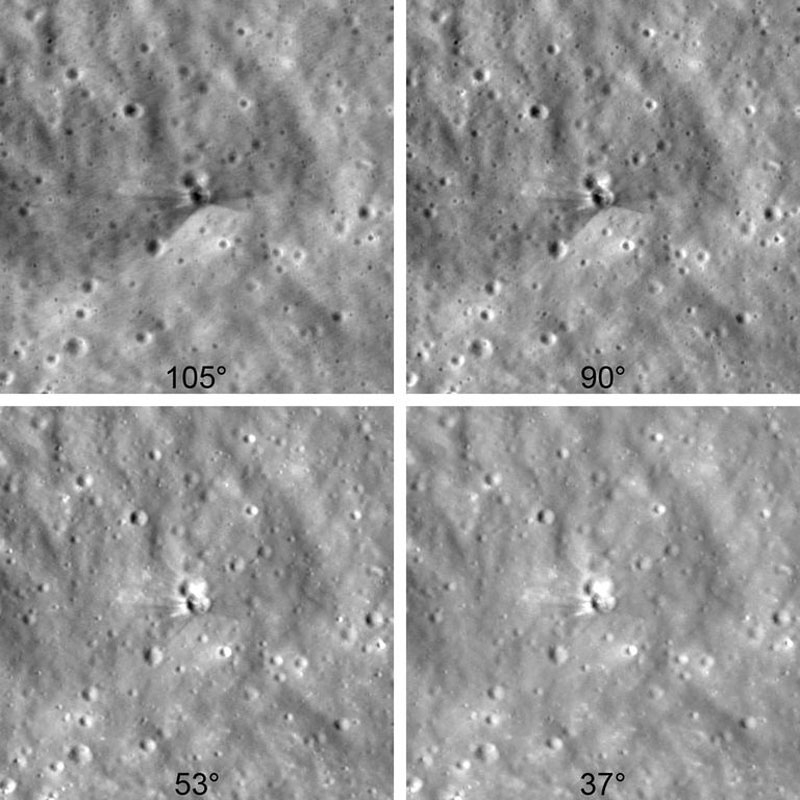
The characteristic light and dark rays of the ejecta are found around the crater. The Dark Belt consists of near-surface regolith that has been modified by long periods of solar wind, galactic cosmic rays, and micrometeorite impacts. Researchers estimate that the impact ejected this material from a depth of about 45 centimeters. The brighter areas immediately adjacent to the crater represent relatively fresh material, rising from greater depths and previously largely untouched by space weathering. The random descent of the steps therefore gives researchers the opportunity to study differences between the upper and deeper layers of lunar regolith.
The determination of the crash site was a joint effort between independent astronomers, NASA and South Korea’s Danuri mission. Experts at NASA’s Center for Near-Earth Object Studies (CNEOS) calculated the trajectory of this stage and predicted the impact point. The Danuri installation’s LUTI camera took photos of the crater hours after the fall, and the results showed that the calculated point was about 1 kilometer different from the actual point. After analyzing the LRO images, NASA determined the coordinates of the crater’s center. NASA pointed out that this observation also became a practical test of methods for predicting collisions between space objects and celestial bodies.
If you find an error, select it with your mouse and press CTRL+ENTER.