

In recent years, global satellite navigation systems have repeatedly proven themselves vulnerable to signal jamming and spoofing, forcing us to look for alternative ways to determine coordinates. The Earth itself can serve as one of these landmarks: seamounts, ocean trenches, and inhomogeneities in the Earth’s crust produce small but stable changes in its gravity field. Australian Q-CTRL experts learned use Navigating these anomalies requires the help of quantum mechanics.
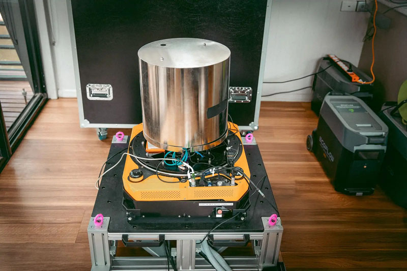
Image source: Q-CTRL
Seamounts, trenches, continental shelves and inhomogeneities in the density of the earth’s crust will slightly change the magnitude of gravitational acceleration, resulting in unique spatial “undulations” of the gravity field. By comparing the measurement sequence to pre-compiled maps of gravity anomalies, the navigation system can determine the vessel’s position and correct for inevitable accumulated inertial navigation errors.
About the latest developments article Australian company Q-CTRL reports on arXiv.org. According to her, she was the first person to demonstrate navigation of a sea vessel without the use of satellite signals and to determine coordinates through the inhomogeneity of the Earth’s gravitational field. The new method is called GravNav and develops ideas from the previously created Q-CTRL system MagNav, which is also guided by magnetic field properties. For ocean navigation, the gravity option is particularly convenient since fairly detailed maps of ocean gravity anomalies are available.
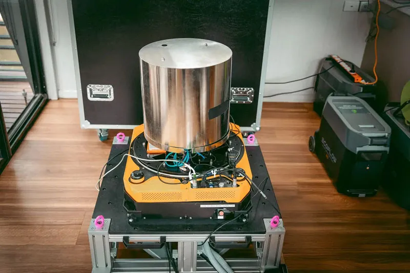
The test was conducted on a 29 meter long ship in the Coral Sea. A quantum gravimeter installed directly in the cabin continuously measures local gravity acceleration, and the navigation system compares the resulting profile with a gravity anomaly map. Positioning error remained at approximately one nautical mile (1.85 km) over the 83-km route. According to Q-CTRL, this is more than ten times better than the performance of backup-level navigation systems used without GNSS.
The technology created by Q-CTRL is based on quantum sensors, where atoms act as sensitive elements. The gravimeter uses a cloud of rubidium-87 atoms, whose interactions are controlled through laser pulses. Atoms fall freely under the influence of gravity, and the resulting phase shift allows for extremely precise measurements of local gravitational acceleration. The resulting values are then compared to gravity anomaly maps, helping to correct the coordinates calculated by the inertial navigation system.
The main issues with such sensitive quantum equipment on board ships are constant vibration, pitch and acceleration. To compensate for these disturbances, quantum sensors are combined with conventional accelerometers, and the system uses a navigation inertial measurement unit alone. Classical sensors track fast motion very well, while atomic sensors provide long-term stable reference values: in a 56-hour steady-state test, the combination with atomic sensors reduced long-term drift by about 70 times compared to the classical channel alone.
Equally important, the device can operate successfully in a regular cabin without the need for special temperature stabilization, gyroscopic platforms or periodic calibration. In other words, the experiment shows that the quantum gravimeter can operate not only in the laboratory, but also on a moving ship under real sea conditions. In individual tests, the system remained operational in sea conditions up to four points.
Q-CTRL has previously tested its quantum navigation platform on aircraft and ground transportation, but it used a MagNav system guided by the Earth’s magnetic field. According to the company, by 2025 it will be 100 times more accurate than high-end traditional GPS alternatives. The military is already interested in the development of Q-CTRL: the company is working with DARPA, the U.S. Department of Defense’s Defense Innovation Unit, the Australian Department of Defense, the British Royal Navy and other AUKUS partners.
If you find an error, select it with your mouse and press CTRL+ENTER.